  |
||||

|
 The midlands of Tasmania are famed for their agricultural and heritage
values, while the central highlands is renowned for its beautiful
isolated wilderness value. Major towns in the
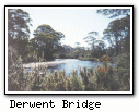
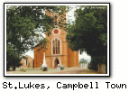
midlands are Oatlands, Campbell Town and Ross, while
the most significant town in central Tasmania is Bothwell.
The midlands of Tasmania are famed for their agricultural and heritage
values, while the central highlands is renowned for its beautiful
isolated wilderness value. Major towns in the
midlands are Oatlands, Campbell Town and Ross, while
the most significant town in central Tasmania is Bothwell.
This page gives a regional overview. For more detailed information, use the links to the left or click the relevant city/town on the map. Attractions
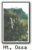
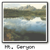
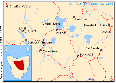
Tasmania's central highlands, consisting of a series of mountains and lakes in the Great Western Tiers range, are largely contained in the Cradle Mountain-Lake St. Clair National Park. The spectacular World Heritage-listed scenery and easy bushwalks around Cradle Mountain make it Tasmania's most popular destination. Lake St. Clair, gouged out of the rock by glaciers, is over 200 metres deep and is a popular fishing and camping site. The Lakes region is a trout fishing paradise, with Great Lake and Arthurs Lake being particularly popular. Many midlands towns possess historic value, having been created as stopping points where travellers between Hobart and Launceston could rest and change horses. There are many craft shops, making midlands towns well worth a detour when travelling. Economy
The central highlands is the site of many of Tasmania's hydro-electric power stations, historically a major regional employer. With hydro-electric construction currently on the wane, tourism, agriculture and forestry have become more important employers. Transportation The Tasmanian midlands are traversed by the Midlands Highway, the main road artery connecting the cities of Hobart and Launceston. This allows any point of Tasmania to be reached quickly. The central highlands, being a mountainous area, has more winding roads. Coaches provide service to midlands towns and to Cradle Mountain. © 1995-2010 |
|||