  |
||||

|
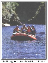 The Gordon-Franklin Wild Rivers National Park occupies 440,961 ha. in western Tasmania. It has been named a World Heritage conservation area by the United Nations. The park offers canoeing and rafting in white water rapids, and lengthy bushwalks for experienced bushwalkers. For the less physically inclined, several cruises operate along the Gordon River out of Strahan.
The Franklin River The Lyell Highway passes through the national park, and there are several walks accessible from the roadside. The Franklin River Picnic Area is located where the highway crosses the river, and there is an interpretative rainforest walk (easy, 20 min) to the river. Nelson Falls is a 20 min walk, and has a viewing platform at the base of the falls. Donaghy's Hill is a moderately easy 40 min (return) walk to a lookout, where the Franklin and Collingwood Rivers can be viewed along with mountains in the vicinity such as Frenchman's Cap and the King William Range.
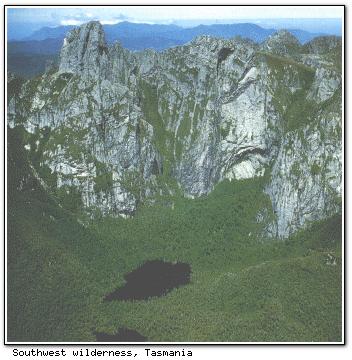 Significantly more challenging is the walk to Frenchmans Cap itself. Passing through testing wilderness (below), this provides great alpine scenery but is only for very experienced bushwalkers and takes approximately four days. © 1995-2010 |
|||